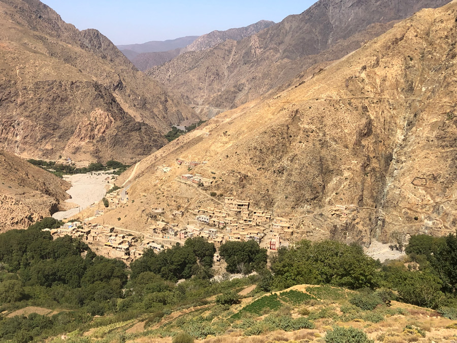
At the end of the road that winds its way into the Zat valley, at the foot of imposing mountains, lies this authentic little village, which until recently was isolated, with its earth and stone houses, narrow terraces perched high up and irrigated by a spring captured at altitude, and two half-millennium-old walnut trees that cast their benevolent shade over the village square.
Who could have known about Anssa, except its inhabitants, before a tarmac road was opened to serve the upper Zat Valley and its name appeared on the map and a few road signs?
Today, it can be reached by a winding but tarmac and safe road. However, it is still necessary to travel 100 km from Marrakech, more than half of which is in the mountains, taking almost 2½ hours. Traffic remains very light beyond Tighdwin, and the road ends at Anssa, a dead end. Beyond the last high mountains that block the horizon south of Anssa, another world opens up: the high plateaus of the Anti-Atlas.
Anssa and its twin village Anamer (around 1,700 metres) are built at the intersection of the wadi Anssa, a short dry tributary of the Zat which flows some 300 metres below, and another steeply sloping tributary, both descending from the steep Oulsoon (3,060 m), immediately adjacent to the imposing Bou Oughyool (3,510 m).


Anssa and Anamer (behind the tree) are built at the confluence of two permanently dry wadis. During the rainy season, they flow towards the Zat wadi, the bend of which can be seen in the background. Anamer is the higher of the two villages. Its secluded position on the mountainside has protected it more from cement than Anssa, where the road ends.
These two villages were not built on the banks of two dry wadis without reason. In fact, their crops are fed by a fairly powerful spring that rises 500 or 600 m higher up the slopes of Oulsoon. The water is collected in a large basin overlooking the two villages (1,894 m) and distributed by an irrigation network to two sets of narrow terraces built on a fairly steep slope. They grow walnut, almond and apple trees, and even a local variety of white peach, which is now rare.


La source qui alimente les deux villages et leurs terrasses se situe beaucoup plus haut sur les flancs de l’Oulsoune. Les eaux sont captées et descendent le long d’une longue séguia qui irrigue en passant quelques jeunes noyers solitaires. Elles sont stockées dans un bassin avant de reprendre leur descente vers les terrasses.
These two villages were not built on the banks of two dry wadis without reason. In fact, their crops are fed by a fairly powerful spring that rises 500 or 600 m higher up the slopes of Oulsoon. The water is collected in a large basin overlooking the two villages (1,894 m) and distributed by an irrigation network to two sets of narrow terraces built on a fairly steep slope. They grow walnut, almond and apple trees, and even a local variety of white peach, which is now rare.
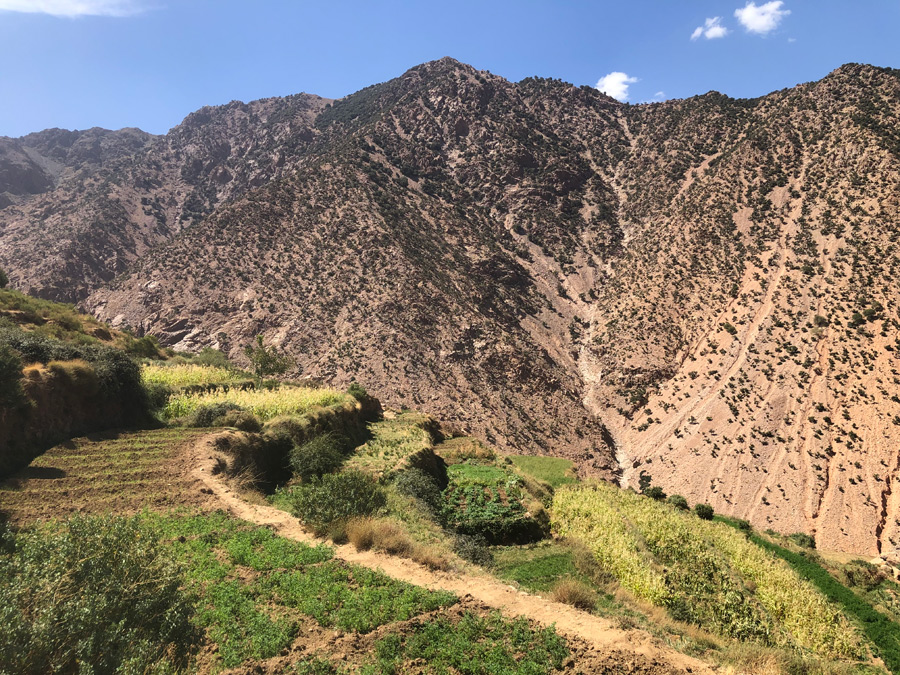
The highest terraces are more recent constructions, an extension of the older ones that once sufficed for the two villages.
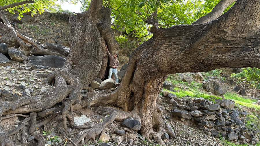
Two venerable walnut trees, overlooking the village square where gatherings and festivities are held, have stood for centuries, probably five or more, judging by the circumference of their trunks at the base and the twisted shape of their branches. They have withstood the chainsaws of the loggers who have been plundering the walnut groves for almost half a century.
The villages of Anssa and Anamer are still isolated and little visited.
Access : National Road 9, then the P2016 lead directly to Anssa. It’s hard to get lost: it’s the end of the road, with no junctions where you might take a wrong turn. 100 km from Marrakech, 2½ hours by car.
.
