You may be lucky enough to make the short crossing of the Afra Plateau a few weeks after the spring rains: it is then covered with a high meadow of flowers, which alone is worth coming to see this ephemeral treasure.
The small Afra Plateau is nestled beneath the Tizi-n-Tichka Pass, under the benevolent gaze of Adrar Tircht, the highest point in the area at 3,510 m. It is best approached from above to make the hike more enjoyable.
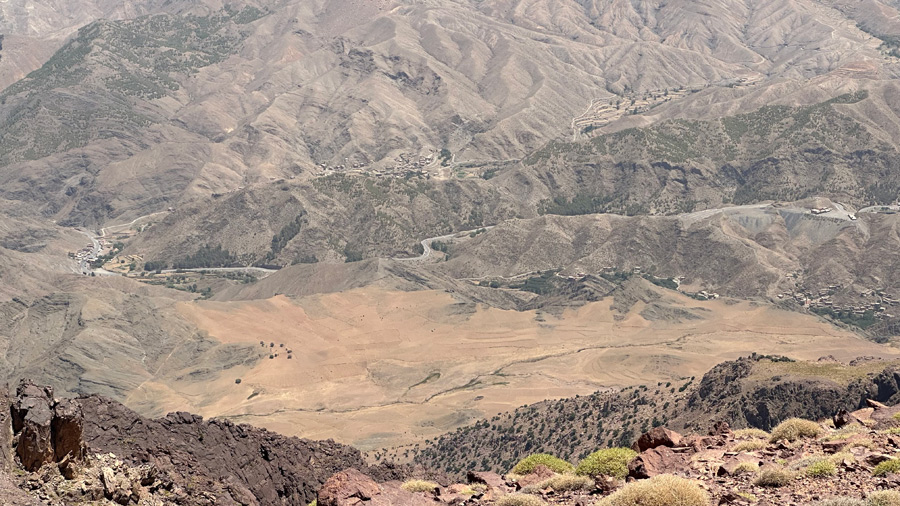
The Afra plateau is dominated to the south by the imposing Tircht, from where the view takes in the whole plateau, as here, in the middle of summer.
A path starts from a café on the side of the N9 road leading to Warzazate, a few kilometres before reaching Tizi-n-Tishka. It descends rapidly in hairpin bends to a mountain stream, which it approaches via a somewhat degraded path, before climbing back up the mountainside and following, unnoticed, the old mining track, abandoned in the 1970s, which has now completely disappeared and is nothing more than a narrow mule track.


Le sentier descend d’abord en virages d’un point d’accès en contrebas du Tizi-n’Tichka, jusqu’à un ruisseau au fond de ravin. Il s’élève régulièrement ensuite à flanc de montagne jusqu’à l’entrée du plateau.
The only visible remains are a thick metal structure embedded in the rock at a point where it was necessary to build a small bridge so that vehicles could pass this cliff point.
The end point of this mountain-side track consists of the remains of the anchor point of a pylon from the old cable car that was used to transport manganese ore extracted from the old mines of Imini and Tikine, south of Tishka, from 1953 until the mid-1970s.
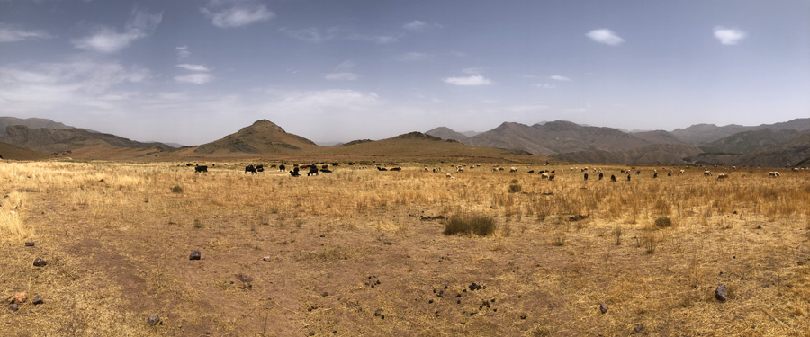
It is from this point that the Afra plateau begins to slope gently, at an altitude of just over 2,000 metres. It is a summer pasture where, from spring until the first cold spells and winter snow, if there is any, the inhabitants of Afra graze their flocks of sheep, cows and mules on these grasslands, to which they have rights of use.


The trail first descends in curves from an access point below Tizi-n’Tishka to a stream at the bottom of a ravine. It then climbs steadily up the mountainside to the entrance to the plateau.
The women of the village make two round trips to the plateau every day to milk their cows in the morning and evening. This double daily walk, which is not exactly short, has been a regular part of their lives since they were old enough to milk.
There are many springs here, the first of which is clearly visible opposite the cable car infrastructure. They feed a seguia that irrigates the terraced crops for the villagers of Afra, located about three kilometres below, at an altitude of 1,840 metres.
The first terraces irrigated with this water begin towards the end of the plateau. Here, vegetables (potatoes, turnips, carrots), fodder for livestock and the essential cereals for bread are grown for self-sufficiency, not to mention straw.
A few rare trees, sturdy junipers several hundred years old, bear witness to a bygone era when the plateau and the entire mountain were covered with a forest that was slowly stripped for timber, fuel and charcoal.
The Afra plateau is a high mountain pasture, above 2,000 m, where the inhabitants’ animals graze from spring until the arrival of the first cold spells and the first snowfall.
The hike, which takes between two and three hours depending on your pace, ends in the village of Afra, which is now served by a fairly high track that leads just below Taddart Izdar, often referred to as Taddart No. 1 to differentiate it from Taddart Ofella just above, No. 2.
The few inhabitants of the village live off agriculture, livestock farming and arboriculture. Most of their fields are located on the Afra plateau and their grazing rights extend high up into the mountains, to the slopes of Adrar Tircht. But they also extend down to the village just downstream, Tidsi.
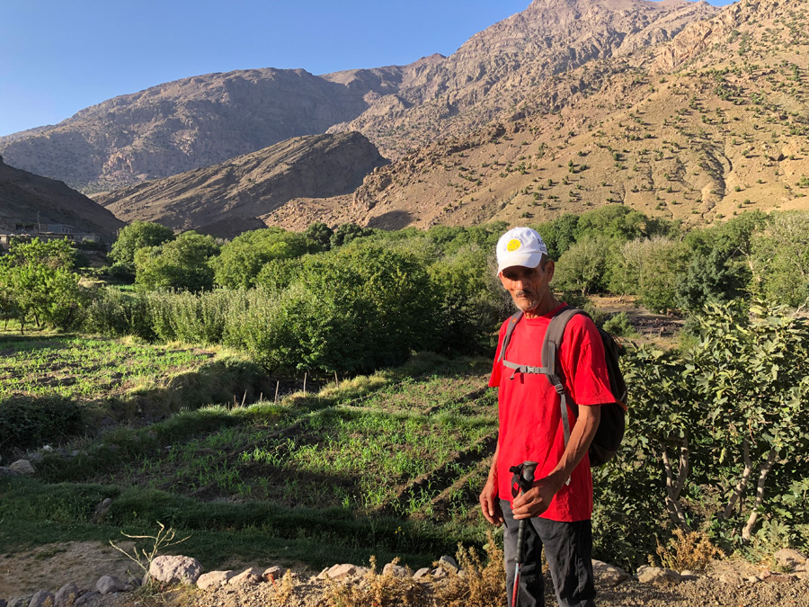
The inhabitants of Afra use the water from the springs, which they channel into a large seguia, to irrigate their fields.
Continuing to follow the stream that flows through Afra, and after the douars of Tidsi, Assadess and Tiwririn, you reach the Wadi Zat at Azgoor after a three-hour walk.
Access : the starting point of the trail that leads to the Afra plateau from above is located 87 km from Dar Rana, 100 km from Marrakech, on the N9 national road leading to Ouarzazate.
.
